
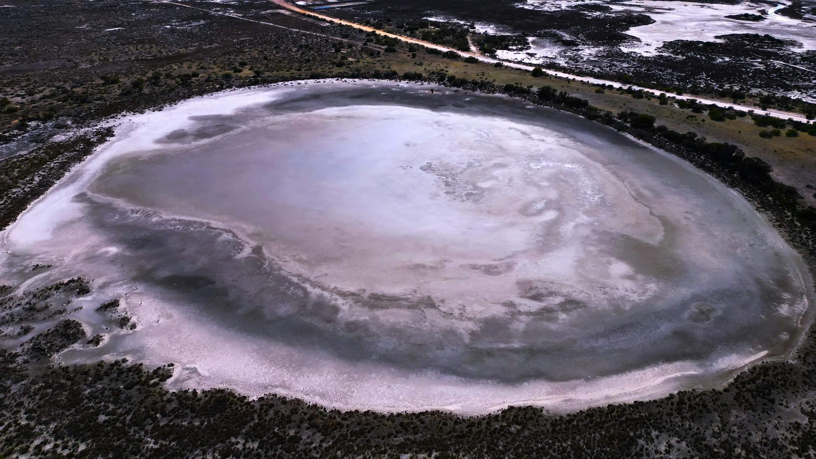
Salt lakes
The EPA has assessed a run of referrals from proponents seeking to abstract potash-rich brines from the surface water and groundwater associated with salt lakes in the more arid parts of Western Australia, and it names three issues of particular interest. Disturbance of the lake surface that may change flooding regimes, leading to inundation of areas outside the lake surface, with saline water, that are not normally inundated. The disposal of large amounts of excess salt from evaporation basins, which may sit on the lake surface itself. And how both of those affect water quality and surface water flows on the lake in the long term, following closure. To that it adds the ordinary arid-zone difficulty of finding freshwater sources at all, and managing them so that the supply does not create a second set of impacts. Every one of those is a surface water question about a landform most people read as flat, static and already saline.
A playa is a hydrological system, not a hardstand
The EPA’s starting position is that these salt lakes can support many unique environmental values, which may be impacted by changes to hydrological regimes. That is consistent with the rest of the guideline: saline lakes reliant on groundwater or surface water inputs appear in its list of significant ecosystems, as do springs and pools, particularly in arid areas, and wetland types poorly represented in the conservation reserve system.
The engineering consequence follows from the landform. A playa is the terminal sink of a large catchment, its inundation is episodic rather than seasonal, and the depth is usually small relative to the area covered. On a surface that flat, the paths water takes are set by centimetres of relief — which means terrain data resolved at that scale is the difference between a model of the lake and a picture of it.
Issue one: anything on the lake surface is an obstruction in a very flat flow field
Trenches, causeways, levees, access tracks and on-lake evaporation ponds all sit in the path of that episodic sheet flow. The EPA’s stated concern is not the footprint itself but the consequence: disturbance of the lake surface that may change flooding regimes, leading to inundation of areas outside the lake surface with saline water that are not normally inundated.
That is a backwater problem in plain terms. Obstruct or redirect shallow flow across a near-level surface and water goes somewhere it did not previously go — and here the water is hypersaline, so the receiving ground is not merely wetter, it is salinised. The land immediately outside a playa is often where the fringing vegetation and the groundwater-dependent communities are, which is why the EPA frames the risk in terms of areas outside the lake rather than conditions on it.
The evidence that answers it is a surface water assessment of the lake under episodic inundation, with and without the proposed works, built on terrain that actually resolves the relief governing the flow paths.
Issue two: the salt has to go somewhere, and it stays there
Brine concentration produces a large volume of residual salt, and the EPA names its disposal directly — the impacts of the disposal of large amounts of excess salt from evaporation basins, which may be on the lake surface. Separately, in its list of activities with potential to impact inland waters, it names the discharge of waste to storage or evaporative basins where there is potential for overflow or leakage.
Placed on a playa, a salt residue store is a long-lived landform sitting on a surface that floods episodically. The questions that follow are hydrological: what the store does to flow paths across the lake, whether the inundation regime remobilises material from it, and what containment behaviour looks like in the rare large event rather than the average year. Arid-zone water risk concentrates into a handful of storms, and a structure assessed against average conditions has not been assessed against the event that will test it.
Issue three: the long term means after closure
The third named issue is how this impacts on water quality and surface water flows on the lake in the long term following closure of the proposal. That is a deliberate framing — not the operating case, and not the year after handover.
It matches the standard the EPA applies to pit lakes elsewhere in the same guideline, where it examines the extent to which the short to very long-term, multi-century, environmental risks have been eliminated or minimised. Read across, the closure landform on a salt lake has to be shown to behave acceptably in flow and water quality terms long after monitoring has stopped, which makes the closure surface water case part of the approval rather than a study to be commissioned near the end of mine life.
And then the freshwater problem
The guideline closes the salt lake issue by noting that these projects also carry the normal issues of finding freshwater sources in the arid regions of Western Australia, and of managing those sources to prevent environmental impacts. Processing and camp supply has to come from somewhere, and in arid country the somewhere is often the same aquifer system that supports the springs and pools the EPA lists as significant.
That connects to another issue it raises about growing abstraction in poorly understood regions: where the hydrogeological knowledge base is thin, the EPA expects proponents of proposals requiring large abstraction to provide additional hydrological information rather than to assume the gap works in their favour. It states elsewhere that it takes the level of knowledge into account when determining environmental impacts and risks, so an assessment in a poorly characterised basin is assessed as such.
Where this practice fits on a salt lake project
The brine resource itself is a hydrogeological question — aquifer properties, brine recovery, drawdown. The three issues the EPA names are surface water questions: inundation extent and flow paths across the playa, the hydraulic behaviour of works placed on it, the containment of residual salt under episodic flooding, and the long-term post-closure condition of both.
That surface water and inland water component is the work this practice does on these projects, as technical input to the environmental consultant running the assessment. It is a body of work the practice has delivered for a Western Australian sulphate-of-potash brine operation, including an ambient environmental monitoring programme built to keep running well past the approval decision rather than stopping on the day it was made.